|
Gunamoi Software
|
|
LEOPoint Program |
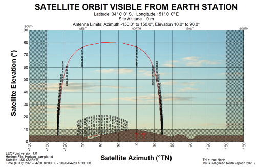
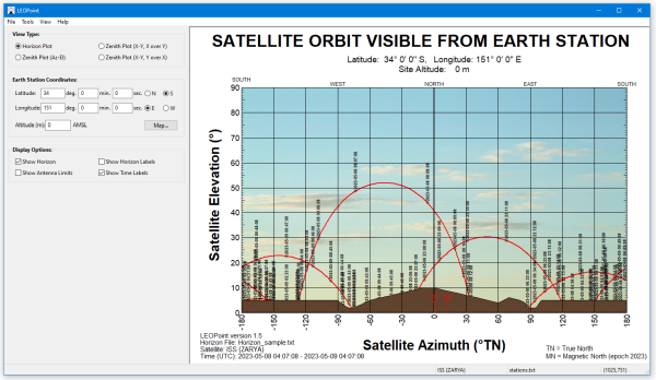
VERSION 1.5 OF LEOPoint - Download here. (or click here to find out what's new) LEOPoint is a tool intended for registered users of our GEOPoint app. Whereas GEOPoint is aimed at only geostationary satellites, LEOPoint can calculate and plot pointing angles for any satellite, from the two-line elements (TLE) parameters of the satellite. The location of the satellite, including date and time, may be plotted on a rectangular sky chart, or a polar type "zenith" sky chart. The azimuth and elevation angles versus time may be saved to file in CSV, HTML, or PDF report formats. As with GEOPoint, the registered user of LEOPoint has full control over the colours, fonts, and background image used on the sky charts. Sample LEOPoint sky chart, including a horizon produced using HorizonProfile, with antenna movement limits shaded:
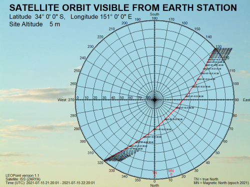
Sample LEOPoint sky chart, zenith style:
LEOPoint is intended for registered users of GEOPoint. There are no free features on this program. Users must have a GEOPoint registration code.
|